Glimpses of Sri Lanka
Alagalla hiking in Sri Lanka (Potato Range)
Alagalla trek (Potato Range) is one of the intermediate level hiking destinations in Sri Lanka. The mountain has two main entry points, one from Ihala Kotte railway station and other one is from Pilimathalawa via Poththapitiya. Either way is reachable within around 2 hours drive from Colombo.
The Ihala Kotte route might be bit difficult for a beginner since the trek itself is a steep climb from the beginning. But from this year onward (2016), you will get a better aid since the local people put concrete steps in steep areas and made a path since there is a Stupa (Pagoda) built and open for devotees on top of the west ridge of the peak. This is much more similar to the upper part of Adams peak, Haramitipana.
How to reach Alagalla
If you are planing via Ihaka Kotte, there is a train leaving Fort by 5.55 a.m and arrives Ihala Kotte station by 8.30 a.m. Note that this is a daily train named Podi Manike which goes to Badulla via Kandy through the misty mountains of Sri Lankan hill country, so that one can plan this trek anytime during the week.

Breath taking view of Alagalla from Kandy – Colombo train
The other option (easy path) is to take Colombo – Kandy ( route #01) bus from Pettah public bus stand and get down from Pilimathalawa. You have to turn left from Pilimathalawa clock tower and take Poththapitiya bus from there. The route goes via Danthure (which is an ancent village where locals fought their legendary battle with British armies in Colonoal era) and will reach the destination with in 30 minutes.
suggested read: 7 Casinos in Colombo
Note: You can reach Poththapitiya by getting down from Kadugannawa as well. But the public transport is limited. However, there is a bus leaving Kadugannawa around 11.15 a.m. My suggestion is go directly to Pilimathalawa because there are plenty of buses going to Poththapitiya which are coming from Kandy side.
Double check your gear and make sure to done your checklist. There is a pharmacy next to clock tower and you can buy first-aid and what not from there.
The best way to summit Alagalla
Start from Poththapitiya bus stand. You will find a concrete pathway which goes towards the tea factory and then turns to the right hand side. Once you see the factory the mighty Alagalla can be seen from the background blocking the Kegalle skies. Go straight while enjoying the morning sun light. Soon you will enter the tea plantations of the area and keep walking towards

Towards Alagalla summit
the path. Note that the the last known place to fill up your water bottles is the Village Water supplying tanks area. You will notice it easily by recognizing the concrete stairway which is on to your life hand side just after crossing the line village. Once you are done, continue the way up till you find the end of the road. There will be a small pathway to the thick jungle. This is a steep climb. You will see the peak flag of Alagalla just before entering in.
From there it is around 2 hours climb to the top of the mountain. Remember to bring 2 liters of water for drinking.
In dry months(Feb – March), it is very hard to find water at the top. Bring some energy boosters, a hat to cover the head and long sleeve skinny and a sun screen to protect your skin from sun light. However during the rainy and other seasons the rock is full of greenish views and you will find leeches almost everywhere. So remember to bring some leech protections like soap, or Siddhalepa (a local balm which has a strong smell and use as a pain killer).
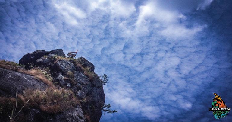
Once you summit Alagalla, there is a small pinnacle on the top of rocks. This is used as a watch tower by local warriors during the British revolution time. Be careful if you are planing to do this climb. Use necessary technical skills as appropriate.

Alagalla
The Pagoda is situated at the other end. So you have to go around the pinnacle and reach to the ridge. There you will find a small path which goes towards the jungle and you will have to walk around 1.5 Km to reach the other end. This is the area when you need to camp if you are planing to stay over night on top of Alagalla. There are plenty of camping sites withing the jungle. Be aware of wild pigs :).
Climbing down to Gangoda or Ihala Kotte Stations
The path to Ihala Kotte starts just before the Pagoda. You will see a small dusty route with a steep descending. Do not rush as the path might be extremely dusty or muddy depending on the month you are doing your trek. The path is more visible and there will be concrete steps made by locals to reach the pagoda. So, keep descending and you will reach Gangoda railway station after around 2 and half hours of descending. There is a water supply on the half way of the descend which has water even in the month of February..
Once you reach Gangoda, you have to walk down through the rail road to reach Ihala Kotte. If there is no specific reason, you can take the same train from Gangoda as well.
There is a train to Colombo from Ganegoda 4.30 p.m so try to plan your time wisely not to miss the train. For the late climbers, talk to the station master and ask for a tuk-tuk mobile. He is a very generous guy and helped us a lot since we decided not to go by train since it is a Sunday evening. We asked the driver to drop us at the bus route where you will find a transport to Mawanella every 15 minutes like.
Note : During your way to Mawanella, there is a breath taking view of Alagalla to your left hand side. Make sure not to miss that moment.
Comments